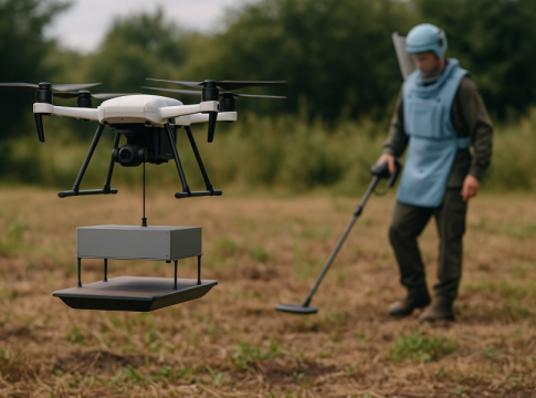
Drones and AI: Pioneering Humanitarian Demining in the Age of Conflict
A Shift in Focus
Since 2014, drones have revolutionized numerous industries, but the onset of war in Ukraine has catalyzed a significant pivot in their application. Humanitarian demining—a critical need in war-torn regions—has become the focal point for drone technology innovators. Since 2022, experts have been exploring how drones, particularly when integrated with artificial intelligence (AI), can automate and enhance demining operations, making them safer and more efficient.
The Role of Drones: Surveying the Landscape
Drones primarily excel during the non-technical survey (NTS) phase of humanitarian demining, where they gather data over expansive areas. Using advanced mapping techniques, drones can flag potentially mine-laden regions, yet they stop short of pinpointing the exact locations of these hazards. The more intricate technical survey (TS) phase, which utilizes trained personnel with metal detectors and canine support, is still required to confirm and map those contaminated areas. The existing processes remain labor-intensive, expensive, and hazardous—demonstrating an urgent need for technological advancement.
Limitations of Current Technologies
Despite their promise, current drone methods show critical limitations:
-
Detection Challenges: Traditional drones equipped with optical or thermal cameras struggle to identify buried or hidden mines, often missing non-metallic mines entirely. In regions like Cambodia, this has led to significant casualties, with 64,000 injuries recorded since 1979 due largely to mines that evade conventional metal detectors.
-
Weather Dependency: Drones reliant on specific lighting conditions suffer performance drops in overcast or low-light environments, severely hindering NTS operations in regions with volatile weather.
- High Costs and False Alarms: Operating costs for current drone technologies remain steep, with instances of teams investigating up to 50 false alarms to find a single real mine. This financial burden is particularly challenging for developing countries, which lack resources for comprehensive demining efforts.
Exploring Innovative Solutions
As the humanitarian landscape evolves, innovative projects are on the radar. One standout initiative involves an array-based ground-penetrating synthetic aperture radar (GPR-SAR) developed by researchers at the University of Oviedo. This technology shows promise by:
-
Enhanced Detection: GPR-SAR can identify buried mines with precision, even distinguishing between different materials like plastic or metal.
- All-Weather Functionality: Unlike conventional imagery, this system can operate effectively in varied weather conditions and at any time of day.
By utilizing radar pulses that detect reflections from subsurface changes, GPR-SAR can create detailed 3D images of the ground. This could mark a pivotal shift towards efficient and cost-effective operational strategies in demining.
The Path Ahead
As we look to the future, the integration of AI with advanced radar technologies has the potential to transform humanitarian demining. The key lies in data accuracy; the more information collected, the more effective AI algorithms can become at recognizing and classifying mine-related hazards. This could not only reduce operational costs—potentially by over 50%—but also significantly enhance safety for both deminers and civilians.
In a world where conflict inevitably shapes technological progress, the adaptation of drones for humanitarian needs may prove to be a beacon of hope—bridging the gap between innovative technology and essential human welfare.

Writes about personal finance, side hustles, gadgets, and tech innovation.
Bio: Priya specializes in making complex financial and tech topics easy to digest, with experience in fintech and consumer reviews.

